
Integrated Laser Measurement, GNSS Positioning & Digital Compass for Geospatial Surveying
TThe TFN RTK Series combines laser ranging, GNSS positioning, and electronic compass technology into a single handheld device, enabling users to capture distance, coordinates, azimuth, pitch, and roll data simultaneously in the field.
Designed for surveying, utility inspection, construction, forestry, GIS mapping, and infrastructure management, the RTK Series streamlines field data collection by reducing equipment requirements and eliminating manual calculations. With measurement ranges up to 1,800 meters and integrated multi-sensor positioning, it delivers faster workflows, greater efficiency, and more reliable spatial data for modern geospatial applications.
- Laser Ranging up to 1,800m
- Integrated GNSS Positioning
- BeiDou / GPS Multi-Constellation Support
- Electronic Compass with Azimuth, Pitch & Roll
- Single, Continuous & Multi-Target Measurement Modes
- Relative Distance Calculation
- Real-Time Geospatial Data Collection
- Internal Data Logging
- GIS & Surveying Workflow ReadyL
Capture Distance, Position, and Orientation in a Single Measurement
The RTK Series combines laser ranging, GNSS positioning, and electronic compass functions into one workflow, allowing users to collect distance, coordinates, azimuth, pitch, and roll data simultaneously. By eliminating the need for separate GPS units, compasses, and rangefinders, field teams can gather complete geospatial information faster and with fewer opportunities for data mismatch.
Measure Remote Targets While Automatically Recording Their Location
Every measurement can be associated with precise geographic coordinates, enabling operators to create location-aware datasets directly in the field. Whether mapping utility assets, recording infrastructure locations, or conducting environmental surveys, the RTK Series reduces post-processing work and simplifies GIS integration.
Adapt to Dynamic Field Conditions with Multiple Measurement Modes
Single-shot, continuous, and multi-target measurement modes allow users to switch seamlessly between rapid spot checks, ongoing tracking, and complex site analysis. This flexibility supports a wide range of tasks, from construction layout and utility inspection to forestry surveys and infrastructure assessment, without changing equipment.
Determine Distances Between Remote Objects Without Changing Position
The built-in relative distance calculation function enables users to calculate the separation between multiple targets from a single observation point. This capability simplifies measurements across rivers, roadways, transmission corridors, or restricted areas, improving safety while reducing time spent moving through difficult terrain.
Improve Survey Efficiency with Real-Time Spatial Intelligence
By combining laser measurement with azimuth, pitch, and roll data, the RTK Series provides a complete spatial reference for every observation. Surveyors and engineers can better understand terrain conditions, target orientation, and site geometry while reducing reliance on manual calculations and secondary instruments.
Measure Across Short and Long Distances with Equal Confidence
With ranging capabilities from close-range measurements to distances up to 1,800 meters, the RTK Series supports applications ranging from building layout and asset verification to long-distance infrastructure inspection. Users can carry a single device that remains effective across multiple project scales and operating environments.
Accelerate Data Collection and Reduce Reporting Errors
Integrated data logging allows measurement records to be stored and reviewed directly on the device, minimizing the risk of lost notes or transcription mistakes. By digitizing field measurements at the point of collection, teams can improve data integrity and streamline project documentation.
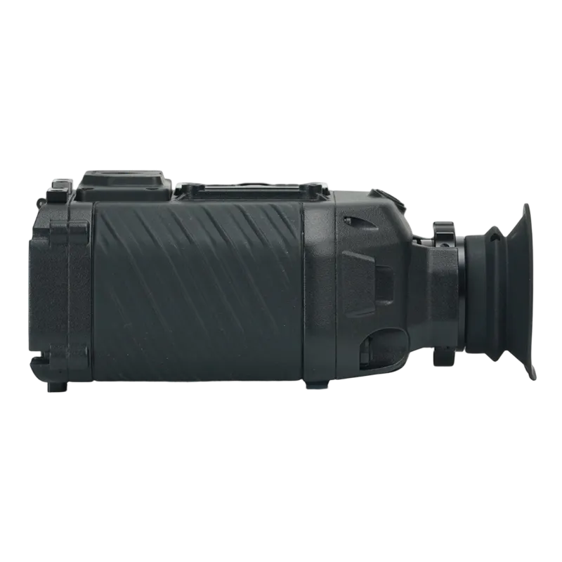
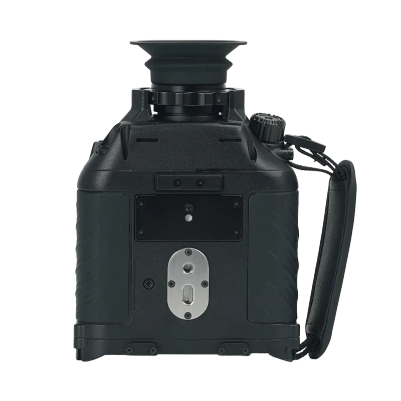
Built for Reliable Performance in Outdoor Environments
The rugged field-ready design withstands demanding working conditions encountered in construction sites, utility corridors, forests, transportation networks, and remote infrastructure projects. Durable construction ensures dependable operation when accuracy and reliability are critical to project success.
| Parameter | Details |
| Models | RT5K (5KM range) RT10K (10 KM range) |
| Measurement Modes | Single shot, continuous, multi-target relative distance |
| Positioning Systems | BeiDou, GPS, Gauss |
| Angle Measurement | Azimuth, pitch, roll (electronic compass) |
| Compass Resolution | 0.01° (typical from display data) |
| Display | High-brightness LCD with backlight |
| Operation Keys | Power, measure, mode select, OK confirmation |
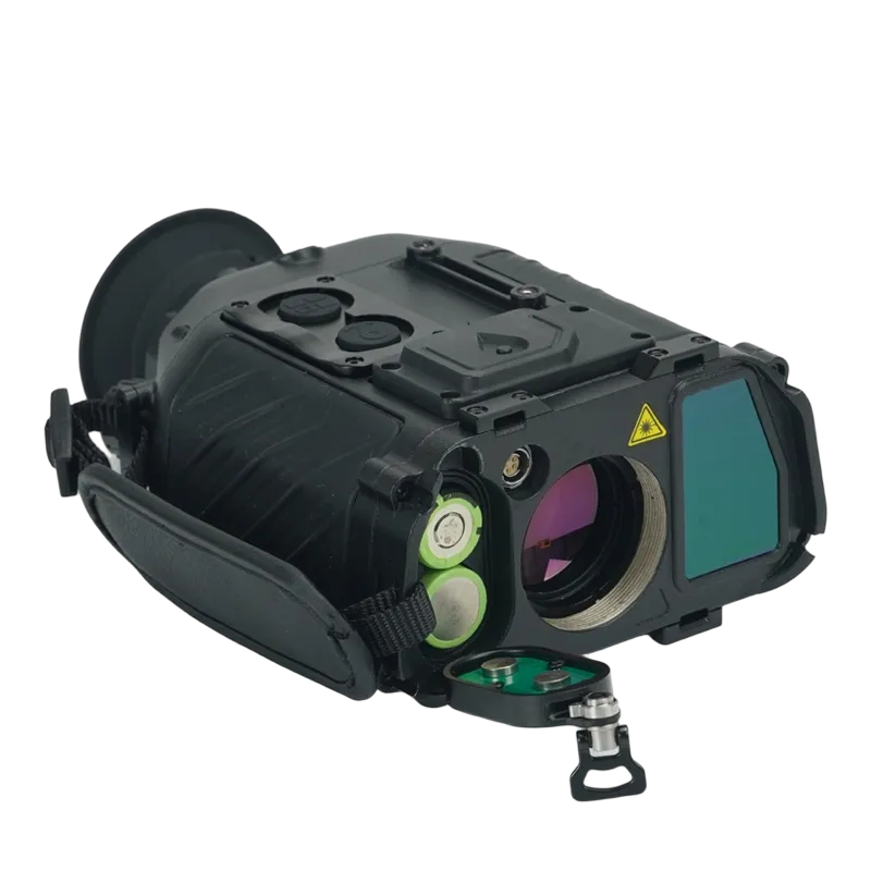
| Battery Life | Up to 12 hours continuous use (typical) |
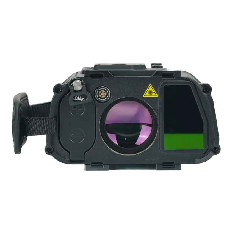
| Laser Class | Class 1 (eye-safe) |
| Working Temperature | -20°C to +60°C |
| Storage Temperature | -30°C to +70°C |
| Water/Dust Protection | IP54 (splash and dust resistant) |
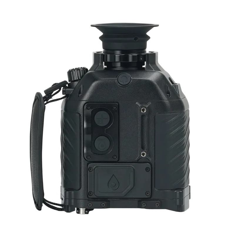
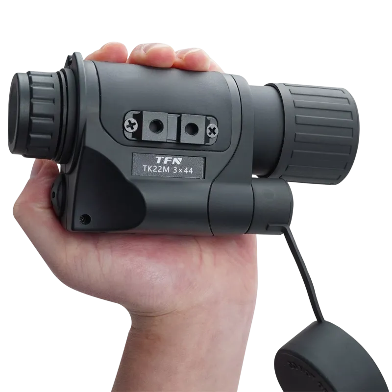
| Dimensions | 125 x 85 x 55 mm (approx.) |
| Weight | 320g (including battery) |
| Data Interface | USB-C / Bluetooth (optional) |
| Tripod Mount | 1/4″-20 threaded hole |
Applications
Target Location and Reconnaissance: Measure target distance while simultaneously recording coordinates and directional information, enabling faster intelligence gathering and more accurate target reporting.
Border Surveillance and Security Operations: Support perimeter monitoring, observation post operations, and incident documentation by providing georeferenced measurements of vehicles, personnel, structures, and terrain features.
Tactical Route and Terrain Assessment: Collect distance, azimuth, elevation, and location data to evaluate routes, obstacles, observation positions, and maneuver corridors during mission planning and field operations.
Search and Rescue Operations: Enable rapid location recording and distance measurement in mountainous, wooded, or disaster-affected areas, improving coordination and situational awareness during rescue missions.
Frequently Asked Questions
A laser rangefinder combines traditional monocular / binocular observation with an integrated laser distance measurement system, allowing users to observe and measure targets using a single device.
Distance gating is a feature that filters out unwanted foreground reflections and allows the rangefinder to prioritize targets within a specified distance range. This improves measurement accuracy in environments containing vegetation, wires, rain, or other obstructions.
Unlike conventional laser rangefinders that only provide distance measurements, the RTK Series combines laser ranging, GNSS positioning, azimuth measurement, pitch and roll sensing, and spatial data collection in a single device.
Yes. The system supports multi-constellation satellite positioning, including GPS and BeiDou, allowing users to associate measurement data with geographic coordinates in real time.
Absolutely. By combining laser measurement with GNSS coordinates and directional information, the RTK Series enables efficient geospatial data collection for GIS databases, utility mapping, and infrastructure inventories.