
Long-Range GPS Laser Rangefinder & Target Locator
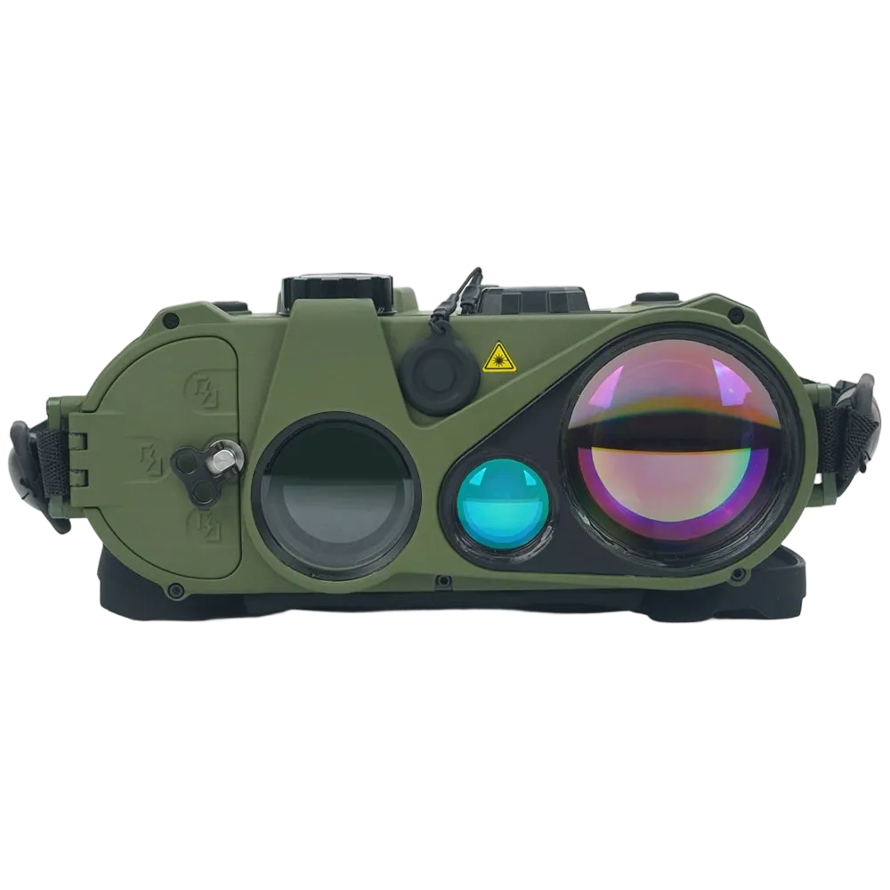
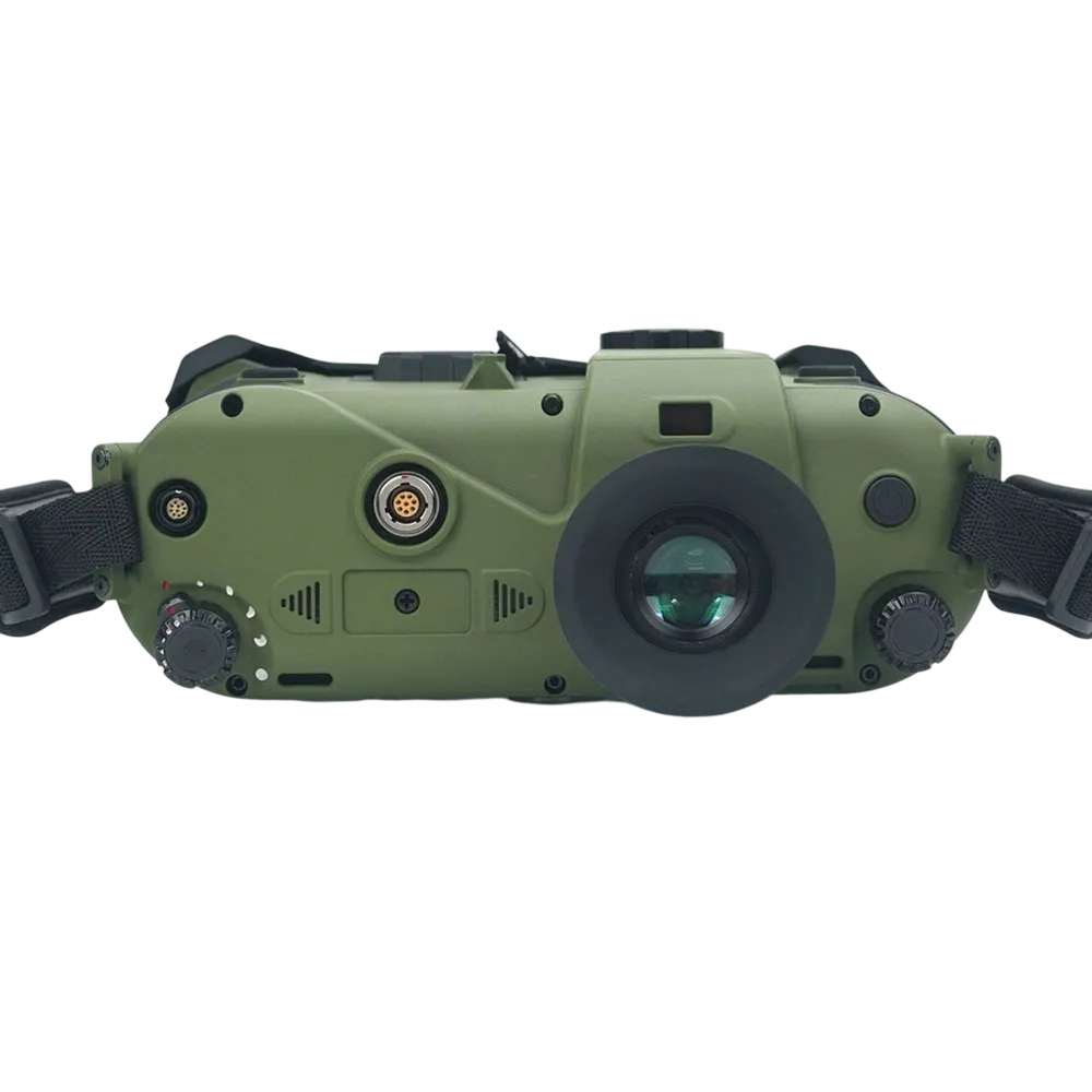
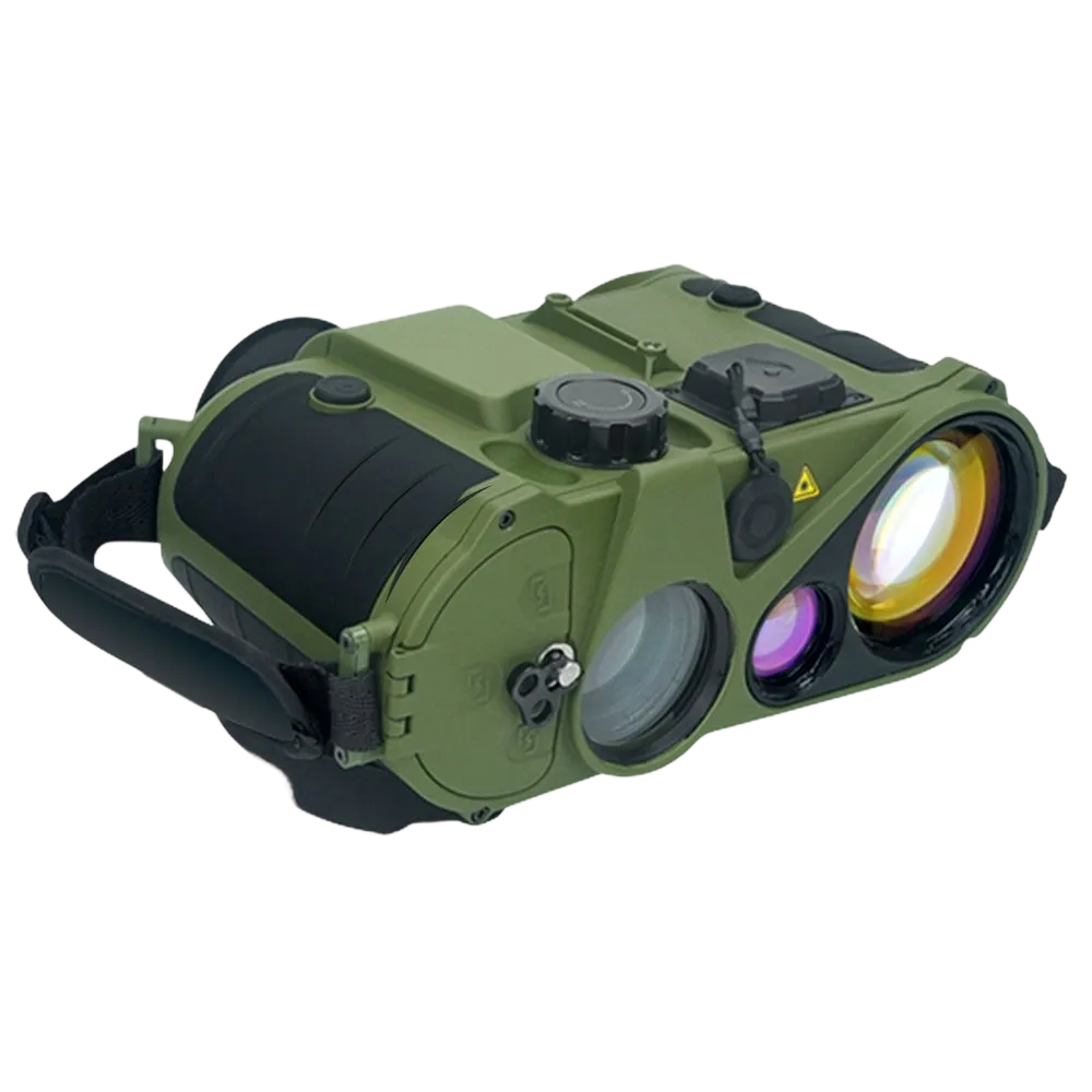
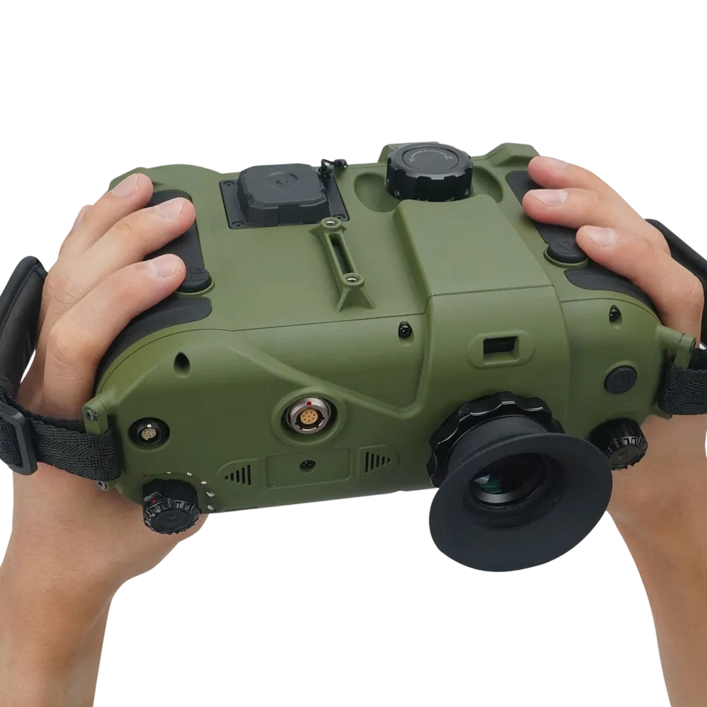
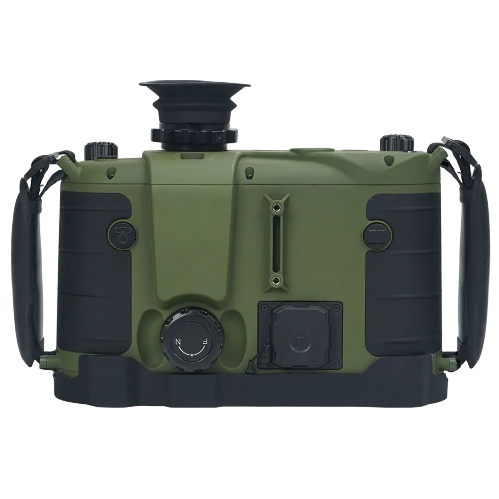

The TFN MW303 is a professional-grade long-range laser rangefinder engineered for military, surveying, infrastructure inspection, and mission-critical field operations. Combining laser ranging, target geolocation, GNSS positioning, digital compass, inclinometer, and environmental sensing into a single handheld platform, it enables operators to accurately locate, identify, and report distant targets without additional equipment.
- Up to 10 km Laser Ranging
- Multi-Target Measurement Capability
- Target Geolocation Function
- GPS / BeiDou / GLONASS Positioning
- Digital Compass & Inclinometer
- Azimuth, Pitch & Roll Measurement
- Temperature, Humidity & Pressure Sensors
- IP67 Waterproof & Dustproof
- 32 GB Internal Data Storage
- USB, WiFi, RS232 & HDMI Connectivity
- 28-Hour Battery Life
- 1535 nm Eye-Safe Laser
Locate and Identify Distant Targets from a Single Observation Point
The MW303 combines ultra-long-range laser measurement with integrated positioning and directional sensing, allowing operators to determine the precise location of remote targets without physically approaching them. Whether observing infrastructure, monitoring border areas, or conducting reconnaissance missions, users can rapidly gather actionable intelligence while maintaining a safe stand-off distance.
Measure Multiple Targets Simultaneously in Complex Environments
The advanced multi-target ranging system can detect and display up to three targets within the same field of view, helping operators quickly distinguish between foreground, intermediate, and distant objects. This significantly improves efficiency when surveying cluttered terrain, monitoring vehicle movements, assessing utility corridors, or observing layered tactical environments.
Generate Accurate Target Coordinates Without External Mapping Equipment
By combining laser distance, azimuth, inclination, and GNSS positioning data, the MW303 automatically calculates the geographic coordinates of remote targets. This enables field personnel to report target locations immediately, reducing dependence on manual map work and eliminating errors associated with coordinate estimation.
Enhance Situational Awareness with Integrated Navigation Sensors
The built-in digital compass and dual-axis inclinometer provide accurate azimuth, pitch, and roll information alongside every measurement. This gives operators a complete understanding of target direction, terrain profile, and observation geometry, supporting faster decisions in surveying, navigation, route assessment, and tactical planning.
Maintain Measurement Accuracy Across Challenging Terrain
Advanced angle compensation and orientation sensing allow the MW303 to deliver reliable distance and directional data on steep slopes, uneven ground, and elevated observation positions. Users can evaluate terrain features, calculate clearances, and assess line-of-sight conditions with greater confidence and reduced calculation workload.
Monitor Environmental Conditions Without Additional Instruments
Integrated temperature, humidity, and barometric pressure sensors provide real-time atmospheric data alongside ranging information. This allows users to better understand local environmental conditions while supporting applications such as ballistic correction, wildfire monitoring, infrastructure inspection, and geospatial surveying.
Operate Reliably in Extreme Field Conditions
Built to IP67 standards and designed for operation from -40°C to +60°C, the MW303 remains dependable in rain, dust, snow, desert heat, and high-altitude environments. Its rugged construction minimizes downtime and ensures consistent performance during demanding field missions.
Capture, Store, and Share Critical Field Data Efficiently
With 32GB onboard storage and multiple communication interfaces, the MW303 allows users to record, review, export, and integrate measurement data into existing workflows. GPS coordinates, target locations, environmental readings, and observation records can be transferred directly to GIS platforms, command systems, or reporting software, reducing administrative workload and improving data integrity.
Support Extended Missions with Long-Endurance Operation
A high-capacity power system provides up to 28 hours of continuous operation, enabling users to complete extended surveys, patrols, inspections, or observation missions without frequent battery replacement or recharging interruptions.
| Optical Specifications | ||
| Optical Magnification | Txt+0.3x | |
| Field of View | 6.7° ~ 40.3° (112m@1000m) | |
| Focus Type | Focus‑free (no adjustment needed) | |
| Objective Diameter | 33 mm | |
| Diopter Adjustment | -5SD ~ +5SD | |
| Laser Ranging Specifications | ||
| Laser Wavelength | 1535 nm (eye‑safe) | |
| Beam Divergence | <0.5 mrad | |
| Minimum Range | 50 m | |
| Maximum Range (Large Target) | ≥10 km | |
| Maximum Range (Small Target) | ≥5 km | |
| Ranging Accuracy | ±1 m | |
| Measurement Frequency | 1 Hz ~ 10 Hz adjustable | |
| Multi-Target Capability | Up to 3 targets simultaneously | |
| Laser Lifetime | >50,000 measurements | |
| Measurement Record | Last 10 targets | |
| Units | Meters, yards, feet | |
| Relative Ranging | Supports 3-point relative positioning | |
| Positioning Specifications | ||
| Positioning Modes | GPS / BeiDou / Glonass / Combined | |
| Self‑Positioning Accuracy | Horizontal: 25m (CEP), Vertical: 10m (PE) | |
| Target Positioning Accuracy | ≤20m (at 5km after map calibration) | |
| Data Update Rate | 1 ~ 10 Hz | |
| Coordinate Systems | SK‑42 / WGS84 | |
| Map Projections | Gauss 6° / UTM / MGRS | |
| Orientation & Inclinometer Specifications | ||
| Azimuth Range | 0° ~ 359° | |
| Azimuth Accuracy | ≤0.3° (5Mil) RMS (device tilt = 0°) | |
| Post‑Map Correction Accuracy | ≤0.1° (2Mil) | |
| Pitch Range | +90° ~ -90° | |
| Pitch Accuracy | ≤0.1° (2Mil) RMS @ -81° ~ 81° | |
| Roll Range | +180° ~ -180° | |
| Roll Accuracy | <0.1° (2Mil) @ -65° ≤ tilt ≤ 65° | |
| Compass Calibration | Manual | |
| Angle Units | Degrees / Mils (Mil) | |
| Storage & Data Management | ||
| Storage Capacity | 32 GB | |
| File Export Interfaces | USB / Wi‑Fi | |
| Display Specifications | ||
| Display Type | OLED | |
| Resolution | 1920 × 1080 | |
| Display Size | 0.5 inch (typical) | |
| Exit Pupil Diameter | 8 mm | |
| Eye Relief | 18 mm | |
| Screen Protection | Auto‑off when face away; auto‑on when eye approaches; anti‑light‑leakage design | |
| External Interfaces | ||
| Ranging Button | Yes | |
| External Power Input | 12V (±3V) | |
| External Control Command | RS232 | |
| Video Output | HDMI | |
| Continuous Operation Time | ||
| Battery Operating Time | 28 hours | |
| With External Power | ≥24 hours continuous | |
| Battery Type | 18650 rechargeable Li‑ion (×4) | |
| Physical Parameters | ||
| Dimensions (L×W×H) | 190 mm × 125 mm × 70 mm | |
| Weight | 0.8 kg | |
| Environmental Adaptability | ||
| Ingress Protection | IP67 (waterproof, dust‑tight) | |
| Operating Temperature | -40°C ~ 60°C | |
| Storage Temperature | -50°C ~ 70°C (optimal 0°C ~ 40°C) | |
| Environmental Sensors (Meteorological) | ||
| Parameter | Measurement Range | Accuracy |
| Temperature | -40°C ~ 60°C | ±1°C |
| Humidity | 0% RH ~ 100% RH | ±3% RH (15%–90% RH); ±5% RH (other ranges) |
| Barometric Pressure | 200 hPa ~ 1100 hPa | ±2 hPa |
Applications
Target Acquisition and Battlefield Observation: Measure distance, azimuth, and target coordinates simultaneously to support reconnaissance, intelligence gathering, and battlefield reporting.
Forward Observation and Fire Adjustment: Provide accurate target location information for indirect fire observation, artillery adjustment, and fire support coordination.
Border Surveillance and Perimeter Security: Monitor vehicles, personnel, infrastructure, and terrain features while maintaining safe observation distances and accurate positional awareness.
Special Operations and Tactical Reconnaissance: Collect target intelligence and terrain information without exposing personnel to unnecessary risk in hostile or restricted environments.
Search and Rescue Coordination: Rapidly identify and communicate the location of stranded personnel, vehicles, or emergency incidents across large operational areas.
Frequently Asked Questions
A laser rangefinder combines traditional monocular / binocular observation with an integrated laser distance measurement system, allowing users to observe and measure targets using a single device.
Yes. The device combines laser ranging, GNSS positioning, azimuth, and inclination measurements to calculate and display the coordinates of remote targets.
The MW303 supports multiple GNSS constellations, including GPS, BeiDou, and GLONASS, providing reliable positioning performance across diverse operating environments.
A military target locator is a device that combines laser ranging, positioning, and directional sensing to determine the precise location of distant targets. The MW303 performs all of these functions in a single handheld platform.
Long-range GPS laser rangefinders are widely used in defense, border security, geodetic surveying, forestry management, utility inspection, mining, environmental monitoring, and search-and-rescue operations.