
Rugged High-Precision Total Stations for Surveying, Construction & Infrastructure Projects
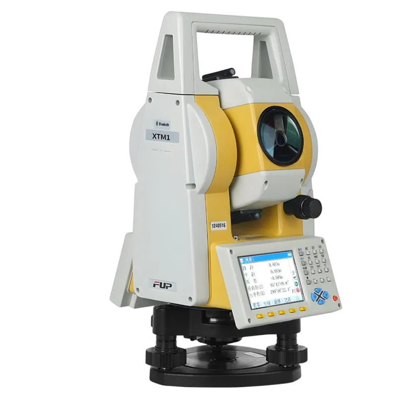
The XTM Series Total Station, represented by the flagship XTM12, is a professional-grade surveying instrument designed for construction layout, topographic mapping, infrastructure development, and engineering measurement.
- 2″ High-Precision Angle Measurement
- 5,000 m Prism Range
- 1,000 m Reflectorless EDM
- Dual-Axis Automatic Tilt Compensation
- IP65 Dust & Water Protection
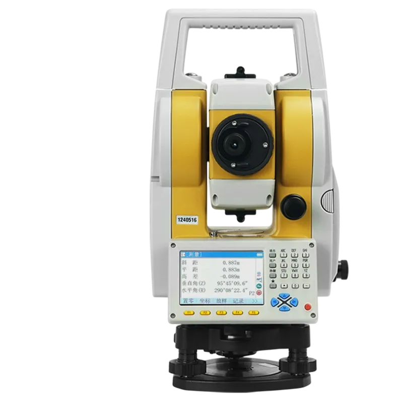
- 3.5″ Sunlight-Readable Color Display
- Built-In Surveying & Stakeout Software
- Bluetooth & USB Connectivity
- Fast Measurement & Tracking Performance
- Designed for Harsh Outdoor Environments
Built for Harsh Field Conditions
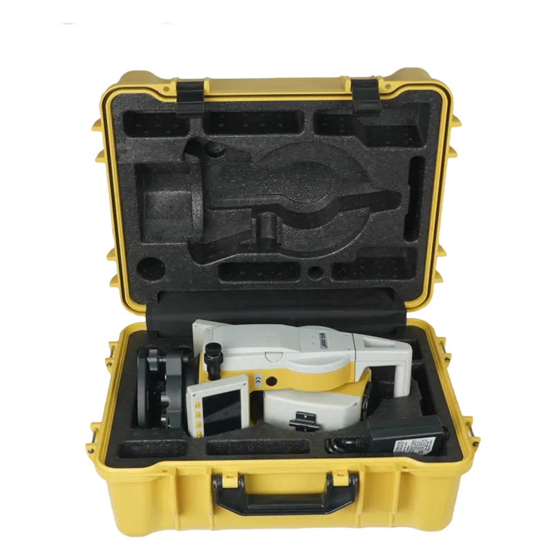
Surveying equipment is constantly exposed to dust, moisture, vibration, and extreme temperatures. The XTM Series is engineered with reinforced mechanical protection and industrial-grade components to withstand demanding field environments.
Its rugged housing, corrosion-resistant structure, and IP65 protection rating ensure dependable operation in construction zones, mining sites, coastal regions, and remote infrastructure projects. Whether working under intense heat, heavy rain, or dusty conditions, survey teams can rely on consistent performance day after day.
High-Accuracy Measurements You Can Trust
Precision is the foundation of every successful survey.
The XTM12 delivers 2-second angular accuracy combined with advanced EDM technology for highly reliable distance measurements. Dual-axis tilt compensation continuously corrects instrument misalignment, helping maintain accuracy even when working on uneven ground or unstable surfaces.
The result is more consistent survey data, reduced rework, and improved confidence in construction layout, control surveys, and engineering projects.
Long-Range Reflectorless Measurement
Many survey points are difficult, dangerous, or impossible to access with a prism.
The XTM Series allows surveyors to measure targets up to 1,000 meters reflectorless, enabling safe and efficient data collection on building facades, bridge structures, cliff faces, utility corridors, and active roadways.
By eliminating the need to physically occupy every point, field crews can work faster while improving job site safety.
Intelligent Surveying Software for Faster Workflows
The XTM Series comes equipped with integrated surveying applications designed to simplify field operations.
Functions including coordinate measurement, stakeout, traverse calculation, resection, road layout, and area computation help surveyors complete complex tasks directly from the instrument.
The intuitive color display and user-friendly interface reduce training requirements and allow crews to become productive quickly.
High-Speed Measurement & Tracking
Construction projects often require rapid data collection and continuous position updates.
The XTM12 provides fast measurement performance and responsive tracking capabilities, helping crews efficiently capture large volumes of survey points while maintaining accuracy.
This makes the system particularly effective for earthworks, infrastructure construction, machine guidance support, and large-scale site development projects.
Seamless Data Transfer & Connectivity
Field data is most valuable when it moves quickly to decision-makers.
Built-in Bluetooth and USB connectivity allow effortless transfer of survey data to field controllers, computers, and mobile devices. The XTM Series integrates smoothly into modern digital workflows, helping reduce manual data handling, minimize transcription errors, and accelerate project delivery.
Survey data can be processed, shared, and archived faster, improving collaboration between field and office teams.
| Angle accuracy | 2″ (2 seconds, ISO 17123-3) |
| Angle display resolution | 0.1″ / 1″ / 5″ / 10″ selectable |
| Dual-axis compensator | Liquid-electric detection, ±3′ range, resolution 0.5″ |
| Prism distance range (single prism) | 5000 m |
| Reflectorless distance range | 1000 m (Kodak white card 90% reflectivity) |
| Distance accuracy (prism) | ±(2 mm + 2 ppm × D) |
| Distance accuracy (reflectorless) | ±(3 mm + 2 ppm × D) |
| Measuring time (fine mode) | 1.2 seconds |
| Tracking mode | 0.8 seconds |
| Minimum display unit (distance) | 0.1 mm |
| Laser class | Class 2 (visible red laser, 630-680 nm) |
| Telescope magnification | 30× |
| Telescope effective aperture | 45 mm |
| Field of view | 1°30′ (2.5 m at 100 m) |
| Shortest focusing distance | 1.5 m |
| Display | 3.5″ LCD color touchscreen, 480×320 pixels |
| Keypad | 20 keys (backlit) |
| Operating system | RTOS with FUP Survey Suite |
| Internal memory | 50,000 points (expandable via USB) |
| Data interfaces | USB 2.0 Host, RS-232, Bluetooth 4.0 |
| Battery | Removable Li-ion 7.4V, 4400 mAh |
| Battery life (single charge) | Up to 12 hours (continuous) |
| Working temperature range | -20°C to +60°C |
| Storage temperature | -40°C to +70°C |
| IP rating | IP65 (dust-tight, protected against water jets) |
| Dimensions (main unit) | 176 mm × 190 mm × 335 mm |
| Weight (with battery) | 5.4 kg |
| Tripod connection | 5/8″ × 11 thread |
Applications
The XTM Series supports a wide range of military engineering, infrastructure, and surveying applications requiring accurate geospatial measurement.
Military Base Construction: Support site planning, facility expansion, utility installation, and infrastructure development within military installations.
Airfield & Runway Surveying: Perform runway alignment verification, pavement monitoring, and airport infrastructure layout with high positional accuracy.
Tactical Infrastructure Development: Assist in the construction and positioning of roads, bridges, defensive structures, communication facilities, and logistics hubs.
Topographic Mapping & Terrain Survey: Collect accurate terrain and elevation data for engineering planning, route analysis, and infrastructure development.
Border & Security Infrastructure Projects: Support surveying and layout of perimeter roads, observation facilities, monitoring systems, and security infrastructure.
Frequently Asked Questions
The XTM Series is used for construction surveying, topographic mapping, engineering measurement, infrastructure development, stakeout, and control surveys requiring high accuracy and reliable field performance.
Yes. The XTM12 features a long-range reflectorless EDM capable of measuring targets up to 1,000 meters without a prism, making it ideal for inaccessible or hazardous survey points.
The XTM12 provides prism measurements up to 5,000 meters and reflectorless measurements up to 1,000 meters, depending on target conditions.
The XTM12 offers 2″ angular accuracy and high-precision EDM performance, making it suitable for engineering surveys, construction layout, and infrastructure projects.
Yes. The instrument features dual-axis automatic compensation that continuously corrects leveling errors and helps maintain measurement accuracy on uneven terrain.