
Advanced surveying and engineering total station
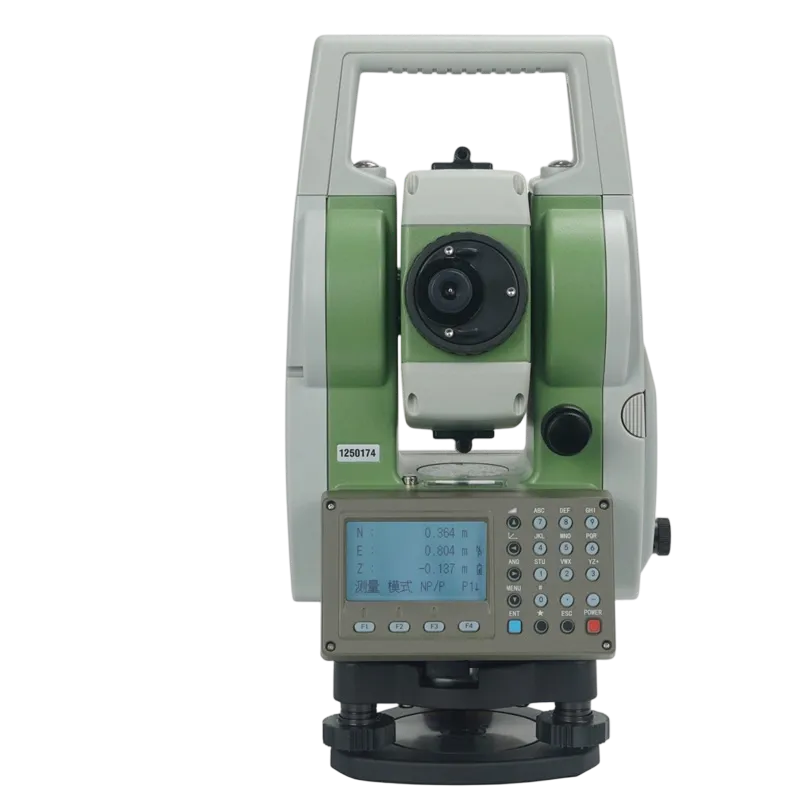
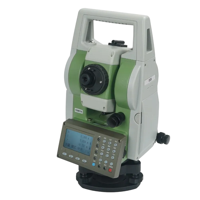
The XS5 is a high‑precision, multi‑purpose total station designed for surveying, construction, infrastructure, and engineering projects where accuracy and reliability are critical. It combines advanced EDM technology, automatic dual‑axis tilt compensation, and a rugged field‑ready design to deliver dependable performance in challenging environments.
- Independent dual‑axis tilt compensation
- Ultra‑fine laser beam with strong signal return
- Reflectorless and prism measurement capability
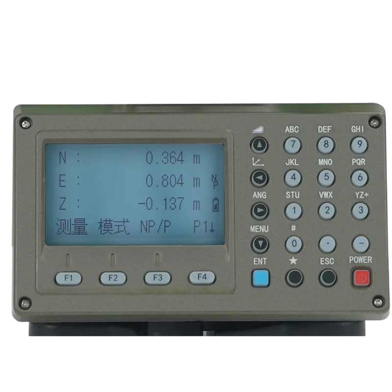
- Sunlight‑readable colour display
- Dedicated alphanumeric keypad
- Endless 360° rotation in both directions
- Flexible instrument height configuration
- Rugged IP55‑class field protection
Automatic Tilt Compensation
The XS5 continuously monitors instrument tilt on two axes and automatically compensates for residual leveling errors. Survey crews can begin work faster, maintain accuracy on uneven terrain, and avoid costly re‑measurement caused by ground settlement or imperfect setup.
High‑Strength Laser Measurement
A specially collimated laser produces a narrow beam with minimal divergence, resulting in stronger reflected signals and more reliable measurements. The XS5 performs confidently on difficult reflectorless targets and in conditions such as dust, haze, or light vegetation where weaker systems may struggle.
Intuitive Colour Interface
The large colour display and dedicated alphanumeric keypad simplify data entry, coding, and job navigation. Graphical workflows reduce training time for new operators and help minimize input errors, improving both field productivity and office data quality.
Continuous 360° Rotation
The endless rotation design eliminates cable twisting and mechanical stop points. Operators can quickly move between targets, complete monitoring sequences smoothly, and work more efficiently in congested construction or infrastructure environments.
Flexible Field Deployment
Compatible with standard tribrachs and tripods, the XS5 supports a wide range of instrument heights and mounting configurations. One platform can be deployed across roadwork, tunneling, structural monitoring, and topographic surveying projects.
All‑Weather Reliability
Designed for demanding outdoor use, the XS5 resists dust, rain, and temperature extremes. Its rugged housing and durable optics help maintain accuracy and uptime across long‑term infrastructure and industrial projects.
| Model | XS5 |
| Type | High‑precision multi‑purpose total station |
| Distance Measurement | Fine laser beam, strong signal return, reflectorless & prism mode |
| Angle Measurement | Absolute encoding, dual‑axis compensation |
| Tilt Sensor | Independent dual‑axis tilt sensor, automatic error correction |
| Rotation | 360° continuous (both directions) |
| Display | Colour LCD, sunlight‑readable |
| Keyboard | Alphanumeric keys + dedicated function keys |
| Sighting | Coarse sight, objective lens |
| Laser Class | Class 1 (visible red laser, typical) |
| Instrument Height Range | Adjustable from 0.000 m to 0.864 m (increments as low as 0.010 m) |
| Dimension Reference | 155 mm (product display reference) |
| Operating Temperature | -20°C to +50°C (typical) |
| Protection Class | IP55 (dust & water jets, typical) |
| Power Supply | Removable Li‑ion battery, hot‑swappable |
| Data Storage | Internal memory + USB / SD card (typical) |
| Communication | RS‑232, Bluetooth optional |
| Weight | Approx. 5.2 kg (including battery, typical) |
Applications
The XS5 can support a variety of defense‑related surveying and engineering tasks where precise positioning and reliable field operation are required:
Military Base Construction & Expansion: Layout and verification of roads, runways, utilities, storage areas, and support facilities with high positional accuracy.
Fortification & Protective Structure Surveying: Measurement and stakeout for bunkers, barriers, defensive earthworks, and hardened infrastructure projects.
Airfield & Runway Maintenance: Precise alignment and deformation monitoring of military airfield pavements, lighting systems, and associated infrastructure.
Bridge & Infrastructure Monitoring: Repeatable measurements for bridges, retaining walls, and critical transport assets where structural movement must be tracked over time.
Topographic & Geospatial Data Collection: Establishment of control networks and collection of terrain data for engineering planning, logistics, and infrastructure management.
Frequently Asked Questions
The XS5 is used for surveying, construction layout, topographic mapping, infrastructure measurement, and engineering positioning tasks that require high accuracy and reliable field performance.
Yes. The XS5 includes an independent dual‑axis tilt sensor that automatically compensates for leveling errors, helping maintain accurate angle and distance measurements.
Yes. Its ultra‑fine laser beam and high‑gain receiver are designed to provide strong signal return for reliable reflectorless measurements on many field targets.
Unlimited rotation allows operators to aim continuously in either direction without cable twist or mechanical stop points, improving efficiency during multi‑point surveys and monitoring tasks.
Yes. The rugged, all‑weather design is intended for operation in dust, rain, and challenging outdoor environments commonly encountered on infrastructure, mining, and industrial projects.